Search This Blog

30 May 2016

thumbnail

PRESS RELEASE — Gexcel at the 3D Faro User Conference Asia Pacific 2016

May 30th, 2016, Tokyo (Japan)


How to efficiently merge Faro Freestyle3D and Focus3D colored point clouds?
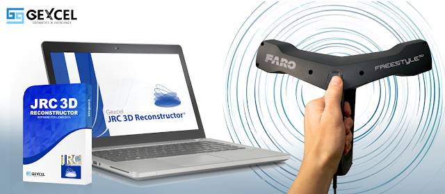
At the 3D Faro User Conference Asia Pacific in Tokyo, Japan (May 31st, 2016 - TKP Garden City Shinagawa) Gexcel will explain how JRC 3D Reconstructor® easily combines colored scans from hand and tripod lasers. This new feature allows to better use and combine multi-resolution and multi-sensor 3D data in a single project.


On Tuesday 31st at 2.30 pm, Mr. Muramatsu Kiyoshishin from Gexcel Japan will manage the workshop focused on the JRC 3D Reconstructor® automatic 3D data alignment in the absence of targets.
Gexcel will also present its new commercial and technical agreement with Siteco, realized to support the spread of the RoadScanner® Mobile Mapping System in the Japanese and Asian markets.


About Gexcel
Gexcel Srl has a rich history spanning more than 10 years of proven fully featured lidar and imagery analysis software packages with the JRC 3D Reconstructor®, completely compatible with all terrestrial, mobile and airborne scanners from manufacturers such as Faro, Teledyne-Optech, Riegl, Stonex, Topcon, Trimble and Z+F. Gexcel Srl was established in 2007 from the academic know-how of the University of Brescia and the applied research achievements of the European Joint Research Centre (JRC), located in Ispra (Italy). Gexcel Srl is proud to support all major standard formats such as the ASTM E57 and LAS.

For more information please contact:
arch. Giorgia Rossi
International Sales Manager | Gexcel Srl
thumbnail

JRC 3D Reconstructor® and FARO® Freestyle3D COMPATIBILITY


Gexcel is glad to suggest you how to get the best results thanks to the
full compatibility between JRC 3D Reconstructor® software and FARO®  Freestyle3D


See the tools of success:


---------------------------------------------------------------------------------------------------------


Will you be there? Come and visit us!

---------------------------------------------------------------------------------------------------------

Giorgia Rossi  -  International Gexcel Sales Manager


7 Mar 2016

thumbnail

PRESS RELEASE — New JRC 3D Reconstructor® 3.2.1 and LineUp® Pro automatic target-less registration tool now available also for Topcon GLS-2000 users

7th March, 2016, Italy — During the Topcon Solution Seminars 2016 — that will take place on March 11th in Hanoi, Vietnam (Daewoo Hotel Hanoi) and on March 15th in Bangkok, Thailand (Thaiarmy Club Bangkok) — GEXCEL will present the new JRC 3D Reconstructor® 3.2.1 capable to import the new Topcon GLS-2000 laser scanner data formats.

The LineUp® Pro automatic target-less registration tool and the new JRC 3D Reconstructor® 3.2.1 release provide to the GLS-2000 users all the features to support a fruitful and excellent use of the new Topcon laser scanner in the most various and different surveying projects.


"We are very glad that all the Topcon GLS-2000 users can now easily use the capabilities of JRC 3D Reconstructor® in their projects. In particular we already had some preliminary very interesting feedback from test clients, especially in construction/BIM and mining fields of application"
Dr. Matteo Sgrenzaroli (head of the Gexcel's R&D Department) stated


In the recent years, a growing number of Asia Pacific surveyors have become customers of GEXCEL’s software and solutions; GEXCEL is proud to announce that now also the Topcon users community will become part of this network.


About Gexcel
Gexcel Srl has a rich history spanning more than 10 years of proven fully featured lidar and imagery analysis software packages with the JRC 3D Reconstructor®, completely compatible with all terrestrial, mobile and airborne scanners from manufacturers such as Faro, Optech, Riegl, Stonex, Topcon, Trimble and Z+F. Gexcel Srl was established in 2007 from the academic know-how of the University of Brescia and the applied research achievements of the European Joint Research Centre (JRC), located in Ispra (Italy). Gexcel Srl is proud to support all major standard formats such as the ASTM E57 and LAS.

For more information please contact:
arch. Giorgia Rossi
International Sales Manager | Gexcel Srl
EMail: sales@gexcel.it
Phone: +39 030 65 95 001

Published on:
- http://www.lidarmag.com/content/view/11729/
- http://www.amerisurv.com/content/view/14792/
- http://www10.giscafe.com/nbc/articles/view_article.php?articleid=1411536


3 Mar 2016

thumbnail

JRC 3D Reconstructor: NEW RELEASE 3.2.1


JRC 3D Reconstructor® even more powerful!


New Sensors Integration

Import as Grid Point Cloud your:

- Dot Product DPI-7 scanner
- Faro Freestyle 3D
- Riegl VZ series with Multiple Echoes selection
- Topcon GLS-2000 CL3 and CLR


New 3D Mesh

The newest tool to create closed mesh models for industrial (e.i. tanks), architectural and mining/caves surveying projects.


New Bundle Adjustment

Registration Tools:

More powerful tool for automatic target-less scans registration and new optimized bundle adjustment feature to minimize the global registration errors.


New BIM Format Importing

New advanced tool to compare a CAD master model and the as-built or part of an object. 
Import a 3D model, included the new format IFC (Industry Foundation Classes) and STL or easily create a 3D mesh model out of your scan data. 
Use the unique Inspection feature with the newest Color Mapping Tool to detect displacement and deformation.


New Measuring Unit System

Manage your projects in the preferred unit of measurement: 
Metric, Imperial, US Survey Feet 
(m | cm | mm | km | th | in | ft | yd | ch | fur).
You have now control on how lengths, areas and volumes will be formatted in all JRC 3D Reconstructor® windows, outputs, PDF reports, etc.


FOR MORE INFORMATION, CONTACT US:

E-Mail sales@gexcel.it  |  Phone +39 030 6595001  |  Web www.gexcel.it 

1 Jul 2015

thumbnail

JRC 3D Reconstructor: NEW RELEASE 3.1


Gexcel is delighted to announce the new release of JRC 3D Reconstructor 3.1


Registration Tools
> LineUp® Pro
The automatic target-less registration tool now more powerful with the new fast  cloud to cloud alignment improved to reduce scans alignment time and rapidly connect the overlapping scans minimizing the residual errors. Learn more about LineUp...
LineUp® Notes
The new free app for iPad (available on the AppStore) to organize the field work and easily manage large scanning projects. See more...
Perfect with LineUp® Pro thanks to the direct connection to JRC 3D Reconstructor® for automatic scans alignment process. See more...

Models Change Detection
Experiment the new advanced tool:
1. Load a complex *.dxf model or easily create a mesh model out of your scan data
2. Use the new full 3D Inspection tools to detect negative and positive changes according to your model faces directions
3. Analyze and classify your results with the new color palette tool

Orthophotos Tool
Improvements to quickly and easily extract ortho images ready to CAD, using points, meshes and colored models.

*  *  *

DOWNLOAD NOW your 30 days free demo version with LineUp® Pro !


Test the demo version and the new LineUp® Pro with your own data or 
choose one of these light sample projects made with JRC 3D Reconstructor data.

*  *  *

See a real application example of LineUp® Pro technology


8 Jun 2015

thumbnail

PRESS RELEASE — OPMMS: Innovation in Slope and Open Pit Mine monitoring and surveying

8th June, 2015, Toronto — The OPMMS® (Open Pit Mine and Slope Monitoring System) is the well known platform to manage long term surveying and monitoring sessions by using Teledyne-Optech Ilris terrestrial laser scanner.
Now the OPMMS® solution can be furnished along with:
- a rugged control unit
- an automatic and remotely controlled enclosure to protect the Teledyne-Optech Ilris long range laser scanner
- a software to manage long-time monitoring sessions providing deformations maps and statistics, recording 3D data and managing different kind of alarms.


The OPMMS® data can be also used to extract profiles and contour lines, or to obtain volumes from the scanning data.
The OPMMS® 3D data can be merged with points or point clouds coming from UAV, GNSS, total stations, mobile or airborne lidar surveying systems.
The OPMMS® is part of the large family of Gexcel's software and solutions developed to help and support the 3D surveying activities and the data integration processes (of multi-surveying and multi-resolution data) of worldwide clients.

Learn more about OPMMS®

Come and visit Gexcel at the Teledyne-Optech Imaging and Lidar Solutions Conference that will take place in Toronto, June 9-12.


Published on:
http://www.geoconnexion.com/news/opmms-innovation-in-slope-and-open-pit-mine-monitoring-and-surveying/
http://www.amerisurv.com/content/view/13916/
http://www10.giscafe.com/nbc/articles/view_article.php?articleid=1358802


4 Jun 2015

thumbnail

PRESS RELEASE — 4D Inspector® and LineUp® Pro presented in Japan at the FARO 3D User Conference Asia Pacific 2015

4th June, 2015, Tokyo — Gexcel and SGS Gexcel Japan have just attended the FARO 3D User Conference Asia Pacific 2015/Japan where they have presented 4D Inspector® (to remotely control and to run an automatic 3D monitoring project): a solution able to transform the Focus3D in a 3D automatic monitoring system.

Several demos of the powerful new LineUp® Pro target-less registration tool have created large interest and surprise among surveyors and technicians present at the Conference.

JRC 3D Reconstructor - LineUp® Pro is so easily able to perfectly align tens of scans without any geometry constrain, in a so short elaboration time, using only 20% of scan overlap, that the alignment problems can be considered as solved.


Published on:
http://www.geoconnexion.com/news/4d-inspector-and-lineup-pro-presented-in-japan-at-the-faro-3d-uc
http://www.amerisurv.com/content/view/13908/